Purpose & Uses of a Topographic Survey


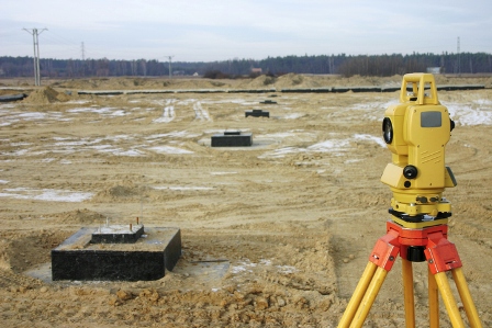
Before construction can begin on a piece of land, a topographical survey (also referred to as a land survey or ground survey) is usually needed.  This type of survey identifies and locates both the man-made and natural features on the property, giving all parties working on the job a reference point from which to start.


What is a Topographic Survey?


A topographical survey differs from other surveys in than it studies and measures the elevation of the land’s surface.  Measurements for a topographical survey are taken using both global positioning systems (GPS) and electronic distance metering (EDM).   The elevation of a parcel is depicted on the survey map through contour lines that represent the contours of the Earth’s surface and also by spot elevations at various points on the map.


The topographical survey will reference surface and underground features, both natural and man-made, such as retaining walls, gas lines, wells, trees, lakes, fences, buildings, utility poles, etc.


Who Uses a Topographic Survey?


Engineers need a topographical survey to see the elevation of the land’s surface and to determine if there is a need to bring in or remove dirt in order to adjust the grade of the property.


Architects might use the survey to create a 3D plot of their design for a construction project.  This plot can be presented to decision makers for approval prior to groundbreaking.


If a building site is limited by significant topographical challenges, such as a steep grade, existing man-made structures or other problematic conditions, a topographical survey should be used before construction begins to ensure the proposed design will work in these conditions.


Governmental agencies also make use of topographical surveys when making and enforcing construction and zoning regulations, evaluating existing infrastructure and needed revisions, and when considering environmental projects.


Topographical surveys are also used to make maps used in industries such as geology, petroleum, and forestry.


If your business needs to order a topographic survey, contact Votex Surveying Company at (469) 333-8831.


The Railroad Survey


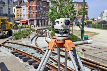
Railroad surveys are those surveys that are performed within or near rail yards or railway corridors.  Railroad surveys differ from those performed in connection with highways and utilities because the surveyor has to use different techniques and, sometimes, different equipment to perform a railroad survey.  Just as with any survey, railroad surveys differ greatly depending on the project.


Railroad Track Profiles and Topographic Surveys


Railroad track profiles and topographic surveys deal with slope, curve and grade of the track and its surrounding areas.  These surveys are needed when new tracks are to be built, or when construction is being done that affects the use of the tracks, such as a new bridge, tunnel, or road that will cross the tracks.  These surveys will include features found on most surveys, plus some that are unique to railroad surveys:


  • Location of existing track centerlines
  • Gage— the distance between the rails. There is a standard gage for North American railroad tracks (4’ 8.5”) that allows rail cars to run on any track on the continent.
  • Existing Rail Section
  • Milepost Reference
  • Right-of-Way Width
  • Location of switches, bumping posts, derails
  • Terminals
  • Valuation Station Reference
  • Buildings
  • Roads
  • Fences
  • Culverts, bridges, or other types of drainage structures
  • Waterways
  • Utilities, both above and under ground


Right-of-Way Surveys


Railroad right-of-way surveys are unique types of surveys that harken back to surveying methods originated centuries ago.  These surveys use historical records and track curve data from railroad surveys completed long ago, to establish original right-of-way.  Right-of-way issues become important when easements are requested for installation of utilities such as gas pipelines, fiber optic cable, and electric power lines.


Railroad surveys come with their own unique challenges and the surveying team doing the job must be experienced and well trained.  If you need a survey on or around a rail yard or railroad, please contact Votex Surveying Company at 469-333-8831 for an estimate on your surveying project.