ALTA Vs. Topographic Surveys

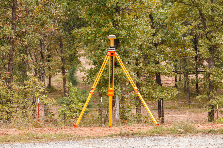
ALTA/NSPS surveys and topographic surveys are two common types of surveys performed on plots of land. Both surveys provide important information about the land, and each survey is useful under different circumstances. Choosing between the two depends on what you intend to do with the property since each is intended to provide specific information.

ALTA/NSPS Surveys

The ultimate purpose of an ALTA survey is to facilitate real estate transactions. More specifically, it provides information that is vital to making sure the transaction is fair. Information included on these surveys includes:

  • Boundaries
  • Improvements, such as buildings and other structures
  • Easements, which are rights of access by utilities, roads, etc.
  • Encroachments, which are intrusions by outside structures onto the property
  • Zoning restrictions
  • Flood zone areas

These surveys must comply with standards set by the American Land Title Association (ALTA) and the National Society of Professional Surveyors (NSPS). As such, they need to be done as precisely and thoroughly as possible, which is helpful when you’re buying or selling land. This ensures that the transaction is completely fair by keeping everyone fully aware of the land’s precise nature.

Topographic Surveys

A topographic survey is fairly straightforward in principle. With this type of survey, the surveyor draws a map of the land with contour lines to mark different elevations, thereby marking out valleys, hills, drainage, and so forth. Additional land features, such as buildings and other improvements, may also be mapped.

These surveys are a necessary part of construction planning since they provide vital information about the lay of the land, drainage, elevation changes, and so forth.

Choosing the Right Survey

Generally speaking, you need an ALTA survey when purchasing land and a topographic survey when planning construction. There are other uses for these as well, and in some cases, you may have both of these done, such as if you intend to develop a plot of land you are purchasing.

Naturally, you need skilled professionals to perform ALTA and topographic surveys. Votex Surveying Company offers skilled surveying services to suit a broad range of needs. Contact us at (469) 333-8831.

Boundary Surveys Vs. Topographic Surveys


Land Survey Map

There are many types of land surveys you can have done on your property, each of which has its own purposes and uses. Two of these are boundary surveys and topographic surveys. Often, one or both of these surveys are necessary if you are looking to purchase, sell, or develop a parcel of land. Here, we’ll go over the uses of these two surveys and how they differ.


Boundary Surveys


A boundary survey does basically what the name implies: it plots out the boundary lines of a parcel of land. This is important when buying or selling land since it provides specific information about where the property ends and where it begins. This helps keep improvements from encroaching on other properties and ensures a fair sale.

In addition to pinning down the precise boundary lines, many types of boundary surveys provide extra information, such as:

• The locations of any easements (permissions to enter or cross the property, such as for utilities)
• Encroachments, or improvements on other properties that intrude into the plot
• Limitations, including zoning regulations

Certain boundary surveys, such as ALTA/NSPS surveys, will include even more information in accordance with ALTA and NSPS standards.


Topographic Surveys


One bit of information that many boundary surveys do not provide is topographical data, or the elevations and contours of the land described in the deed. These surveys will also provide information on any structures on the land, both man-made and natural. This is especially useful for those who intend to develop the land since it gives detailed information on where different features are located.

Features shown on a topographic survey may include:

• Trees
• Slopes, hills, valleys, and other changes in elevation
• Streams and rivers
• Buildings
• Streets and walkways
• Utility poles
• Manholes
• Fences and walls

The elevations on the land are shown on a map as contour lines. Construction contractors, engineers, and architects use this type of map to design and plan improvements to the land.

Contact Votex Surveying Company for assistance with land, topographic, or any type of surveying services you need.

What Is a Tree Survey and When Do I Need It?

Surveyor Performing Tree Survey

Our natural resources are precious and valuable. Conservation of these resources has become a priority for both people and organizations that work to preserve and protect them. Certain species of trees have become sparse in later years due to over harvesting; protecting them has become a priority. Because of this, anyone looking to clear, build on, or study forested land will likely need to obtain a forestry or tree survey before starting the project.


Definition


A forestry survey takes measurements and data on the types of trees in the forested area, where they’re located, how large they are, their age, and so forth. In essence, it’s an assessment of a forested area in general. Topographical data may also be collected.


So When Do I Need One?


If the land for your project just has a few scattered trees on it, you likely don’t need a forestry survey. But, if your project involves clearing out a section of forested area, you should order a forestry survey for the property.


As stated, one of the reasons to perform a forestry survey is to assess what types of trees are present in the forest. Certain types of trees are protected by law, so knowing what’s on the property will help you know if there are any trees you need to avoid cutting or that you’ll need to replace. In this case, you’ll need one of these surveys when:


  • Clearing land for development, either when building new structures or for landscaping
  • Harvesting wood
  • Preparing maps for property resale
  • Performing studies and assessments on the forest for research purposes


It’s important to know that this isn’t just about saving trees. It can also help you assess—or even increase—the value of the property. If you plan to develop the land, knowing what trees are where can help you make plans that incorporate them into the overall plot layout in an aesthetically pleasing way, ultimately improving its value.


Surveying Services


If you are looking to develop any plot of land with or without trees on it, you will need a survey. Professional surveying services, such as those provided by Votex Surveying Company, can help you plan construction, design, and land development wisely.

ALTA Surveys Vs. Regular Surveys

ALTA Surveying
ALTA Surveys Are Used for Real Estate Transactions, Titling, and Mortgages.


There are many types of surveys used when assessing a parcel of land. Among the most common are ALTA/NSPS surveys, called ALTA surveys for short. These surveys differ from more basic surveys in that they must provide highly specific information in accordance with strict standards. When deciding on the type of survey you need for your parcel of land, it helps to know the difference between ALTA surveys and regular border surveys.


Regular Border Surveys


The purpose of a regular border survey is simply to pin down the boundaries of the property. These surveys may also show the easements (permissions that allow others to use or cross the land) as well as other significant details.


These surveys are fairly basic, and as such, generally cost far less than an ALTA survey, but can still be costly for larger pieces of property. Border surveys are primarily necessary for construction and permits, though they also form a foundation for other types of surveys.


ALTA Surveys


ALTA surveys are a more advanced type of boundary survey and are used for mortgage, title insurance, and real estate transactions. ALTA surveys must adhere to very specific requirements set forth by the American Land Title Association (ALTA) and the National Society of Professional Surveyors.


ALTA/NSPS Requirements


These standards are intended to make real estate transactions as fair and comparable as possible. Some of the items that must be included in the survey are:


  • Easements, rights of way, and other encumbrances
  • Encroachments, or improvements on other pieces of property that intrude into the one being surveyed
  • Legal routes to access the property, such as public roads
  • Zoning setbacks, which are improvements that may be in violation of zoning laws
  • Flood zones
  • Water boundaries
  • Evidence of cemeteries
  • A legal description of the property along with plenty of preliminary research


ALTA surveys must be highly precise, meaning there is very little room for error when determining the boundaries and locations of improvements, encroachments, etc.


It takes highly precise equipment and extensive research to perform these surveys. When you need an ALTA survey, or any type of land survey, choose Votex Surveying Company to deliver an accurate, high quality work. Contact Votex today at (469) 333-8831 to discuss the details of your project.

Purpose & Uses of a Topographic Survey


Before construction can begin on a piece of land, a topographical survey (also referred to as a land survey or ground survey) is usually needed.  This type of survey identifies and locates both the man-made and natural features on the property, giving all parties working on the job a reference point from which to start.


What is a Topographic Survey?


A topographical survey differs from other surveys in than it studies and measures the elevation of the land’s surface.  Measurements for a topographical survey are taken using both global positioning systems (GPS) and electronic distance metering (EDM).   The elevation of a parcel is depicted on the survey map through contour lines that represent the contours of the Earth’s surface and also by spot elevations at various points on the map.


The topographical survey will reference surface and underground features, both natural and man-made, such as retaining walls, gas lines, wells, trees, lakes, fences, buildings, utility poles, etc.


Who Uses a Topographic Survey?


Engineers need a topographical survey to see the elevation of the land’s surface and to determine if there is a need to bring in or remove dirt in order to adjust the grade of the property.


Architects might use the survey to create a 3D plot of their design for a construction project.  This plot can be presented to decision makers for approval prior to groundbreaking.


If a building site is limited by significant topographical challenges, such as a steep grade, existing man-made structures or other problematic conditions, a topographical survey should be used before construction begins to ensure the proposed design will work in these conditions.


Governmental agencies also make use of topographical surveys when making and enforcing construction and zoning regulations, evaluating existing infrastructure and needed revisions, and when considering environmental projects.


Topographical surveys are also used to make maps used in industries such as geology, petroleum, and forestry.


If your business needs to order a topographic survey, contact Votex Surveying Company at (469) 333-8831.


The Railroad Survey


Railroad surveys are those surveys that are performed within or near rail yards or railway corridors.  Railroad surveys differ from those performed in connection with highways and utilities because the surveyor has to use different techniques and, sometimes, different equipment to perform a railroad survey.  Just as with any survey, railroad surveys differ greatly depending on the project.


Railroad Track Profiles and Topographic Surveys


Railroad track profiles and topographic surveys deal with slope, curve and grade of the track and its surrounding areas.  These surveys are needed when new tracks are to be built, or when construction is being done that affects the use of the tracks, such as a new bridge, tunnel, or road that will cross the tracks.  These surveys will include features found on most surveys, plus some that are unique to railroad surveys:


  • Location of existing track centerlines
  • Gage— the distance between the rails. There is a standard gage for North American railroad tracks (4’ 8.5”) that allows rail cars to run on any track on the continent.
  • Existing Rail Section
  • Milepost Reference
  • Right-of-Way Width
  • Location of switches, bumping posts, derails
  • Terminals
  • Valuation Station Reference
  • Buildings
  • Roads
  • Fences
  • Culverts, bridges, or other types of drainage structures
  • Waterways
  • Utilities, both above and under ground


Right-of-Way Surveys


Railroad right-of-way surveys are unique types of surveys that harken back to surveying methods originated centuries ago.  These surveys use historical records and track curve data from railroad surveys completed long ago, to establish original right-of-way.  Right-of-way issues become important when easements are requested for installation of utilities such as gas pipelines, fiber optic cable, and electric power lines.


Railroad surveys come with their own unique challenges and the surveying team doing the job must be experienced and well trained.  If you need a survey on or around a rail yard or railroad, please contact Votex Surveying Company at 469-333-8831 for an estimate on your surveying project.